For those who want to go on foot, the distances to most destinations are manageable.
All Ghent residents in the city center will soon receive the RapperTeVoet plan in the mail. This is a schematic pedestrian map of Ghent based on the concept of a metro plan. The plan shows the time it takes to get to a number of important destinations. With the RapperTeVoet plan, the City of Ghent shows that various destinations in the city center are within walking distance of each other.
In this way, the City encourages Gentenaars to walk more often. Residents of the city center will soon receive the RapperTeVoet plan, a folding card that unfolds to A3 format, in the letterbox. The plan is also distributed through the local service centers and can be obtained free of charge from the city services.
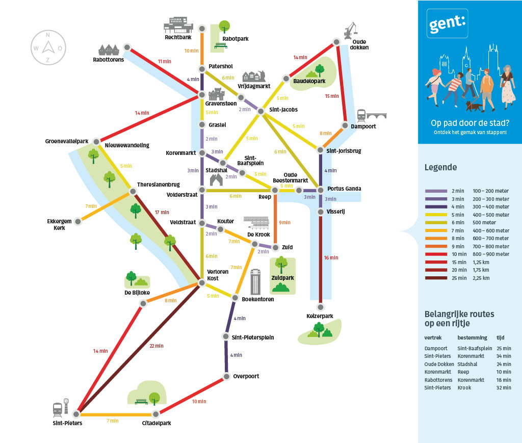
"Ghent is not very big. For those who want to go on foot, the distances to most destinations are good. But time says more than distance. The Metrominuto map therefore gives an idea of the walking time between two destinations. Van De Krook to the Kouter, for example, is only a seven minute walk, seven minutes to enjoy all the beauty in our city.
Filip Watteeuw, alderman of Mobility
The RapperTeVoet plan is a realization within the pedestrian plan of the City of Ghent. That puts forward 16 actions to make Ghent a more walkable city. A city that focuses on active forms of mobility creates space in the city.
This space can be used to contribute to various policy tasks such as health, climate adaptation, densification, cleaner air, infiltration, combi-modality and urban quality. A city tailored to the pedestrian creates more opportunities to realize these themes and by focusing on these themes you contribute to a walkable city.